Experts en topographie, inspections techniques et prises de vues aériennes. Modèles 3D et données certifiées pour les professionnels. Experten für präzise Drohnenvermessung, technische Inspektionen und professionelle Luftaufnahmen. 3D-Modelle und zertifizierte Daten für die Industrie. Experts in precise drone surveying, technical inspections, and professional aerial photography. 3D models and certified data for the industry. Experts in nauwkeurige drone-metingen, technische inspecties en professionele luchtfotografie. 3D-modellen en gecertificeerde data voor de industrie.
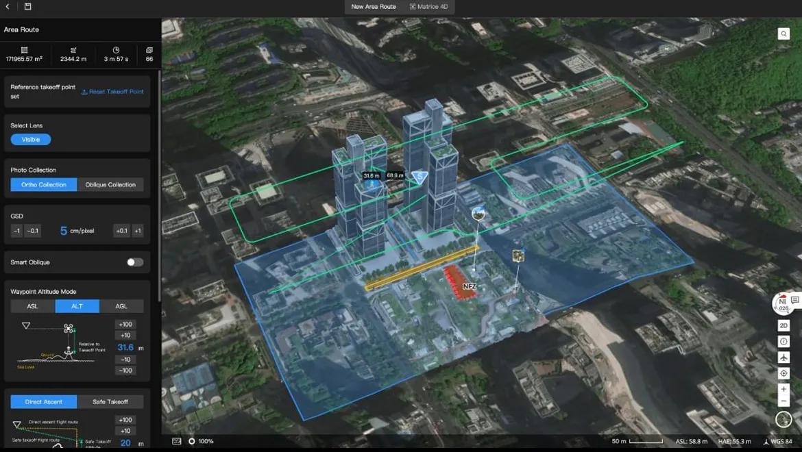
Levés GPS RTK, modèles numériques de terrain et calcul de cubatures. RTK-GPS-Vermessung, digitale Geländemodelle und Massenermittlung. RTK GPS surveys, digital terrain models, and volume calculations. RTK GPS-metingen, digitale terreinmodellen en volumeberekeningen.
Découvrir Entdecken Discover Ontdekken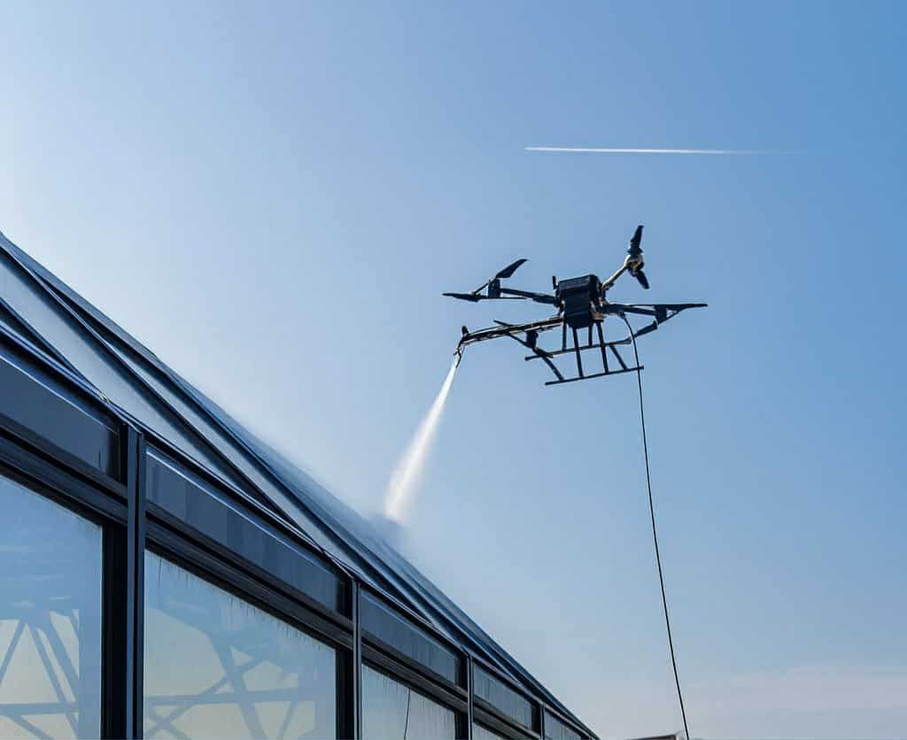
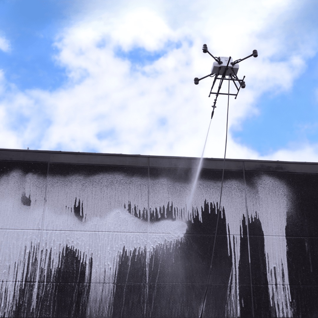
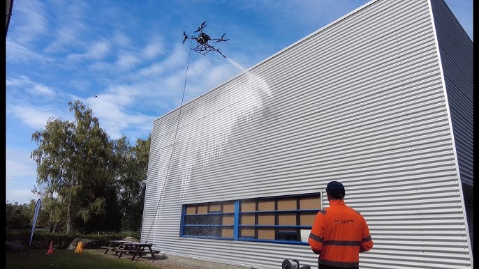
Entretien de façades, toitures et panneaux solaires. Basse pression ciblée et 100% sécurisée. Pflege von Fassaden, Dächern und Solarpaneelen. Niederdrucksprühen und 100% sicher. Maintenance of facades, roofs, and solar panels. Targeted low pressure and 100% safe. Onderhoud van gevels, daken en zonnepanelen. Gerichte lage druk en 100% veilig.
Découvrir Entdecken Discover Ontdekken

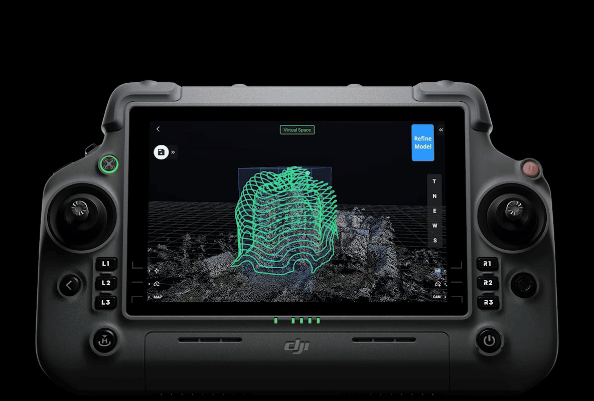
Digitalisation de l'existant : création de jumeaux numériques, orthophotos de façades. Bestandsdigitalisierung: Erstellung digitaler Zwillinge, Orthofotos von Fassaden. Digitization of existing structures: creation of digital twins, facade orthophotos. Digitalisering van bestaande structuren: creatie van digitale tweelingen, gevelorthofoto's.
Découvrir Entdecken Discover Ontdekken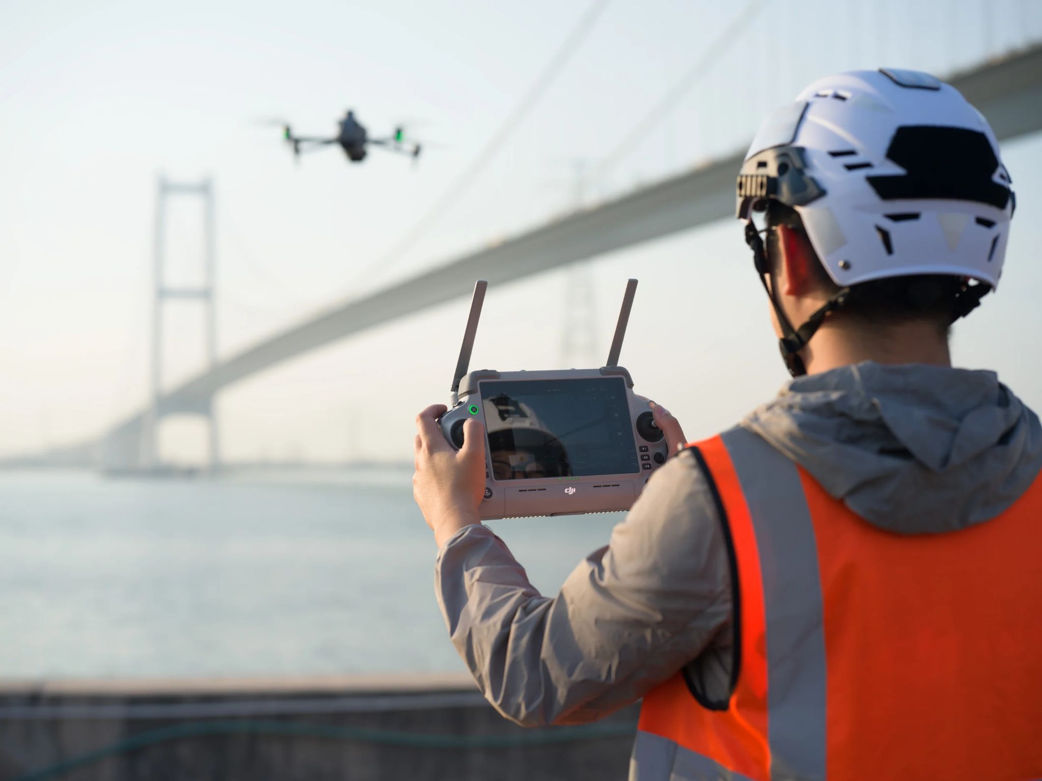
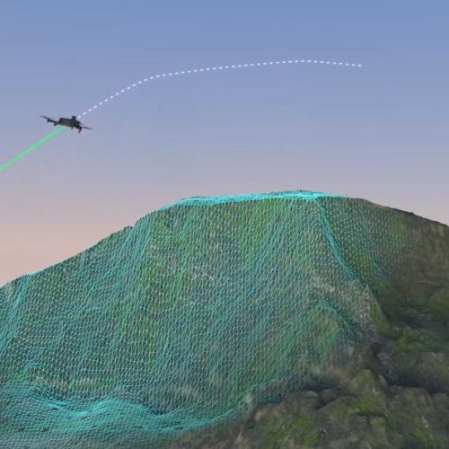
Analyse visuelle experte et identification rapide des fissures ou défauts structurels. Expertenanalyse und schnelle Identifizierung von Rissen oder strukturellen Mängeln. Expert visual analysis and quick identification of cracks or structural defects. Deskundige visuele analyse en snelle identificatie van scheuren of structurele gebreken.
Découvrir Entdecken Discover Ontdekken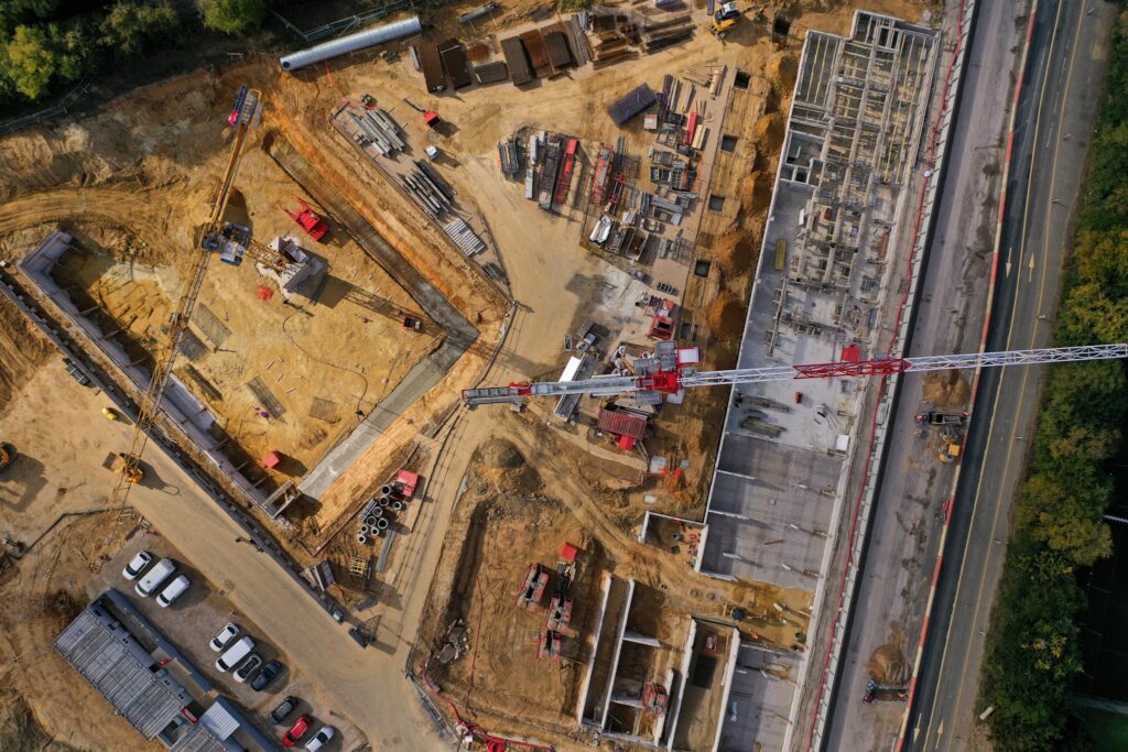
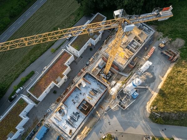
Prises de vues régulières, suivi d'avancement et rapports des phases de construction. Regelmäßige Aufnahmen, Fortschrittskontrolle und Berichte der Bauphasen. Regular aerial shots, progress tracking, and construction phase reports. Regelmatige luchtopnames, voortgangscontrole en rapporten van bouwfases.
Découvrir Entdecken Discover OntdekkenPhotos et vidéos aériennes en haute résolution pour l'immobilier, l'événementiel et la communication. Hochauflösende Luftfotos und -videos für Immobilien, Events und Kommunikation. High-resolution aerial photos and videos for real estate, events, and communication. Luchtfoto's en video's in hoge resolutie voor vastgoed, evenementen en communicatie.
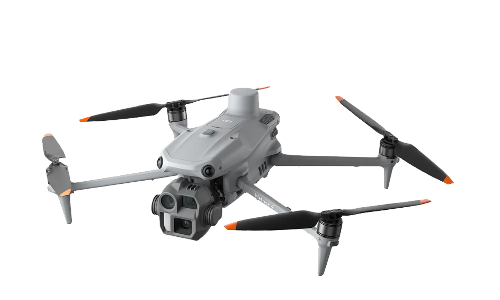
Capture de données à précision centimétrique. Indispensable pour la mesure de surfaces et les relevés de terrain exacts. Datenerfassung mit zentimetergenauer Präzision. Unerlässlich für Flächenmessungen und exakte Geländeaufnahmen. Centimeter-accurate data capture. Essential for surface measurements and exact terrain surveys. Gegevensverzameling met op de centimeter nauwkeurige precisie. Essentieel voor oppervlaktemetingen en exacte terreinopmetingen.
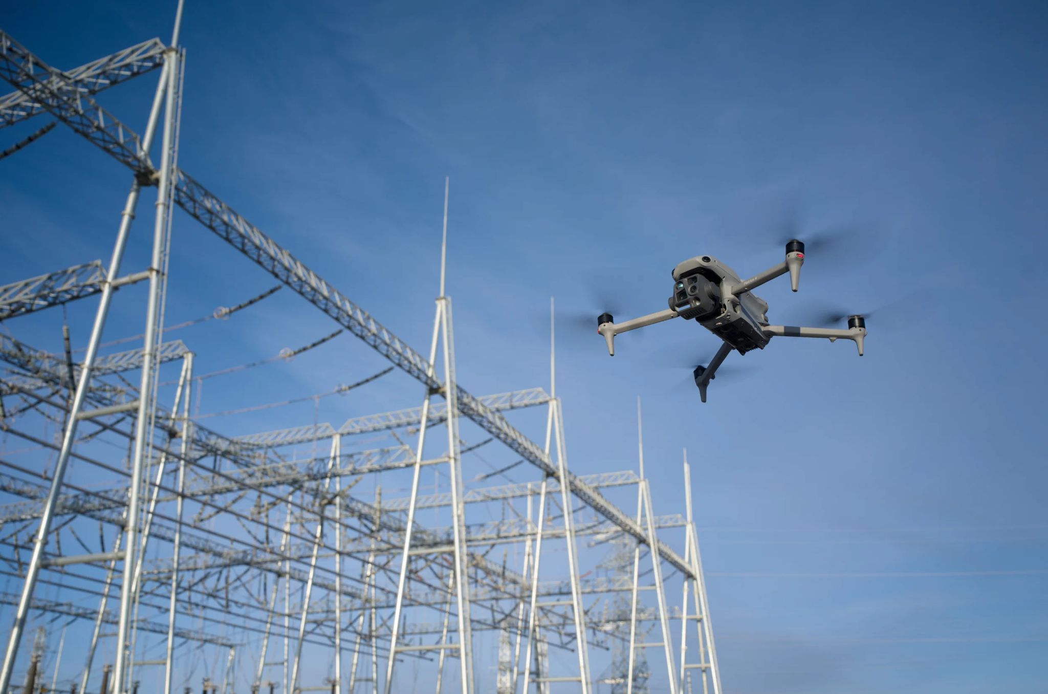
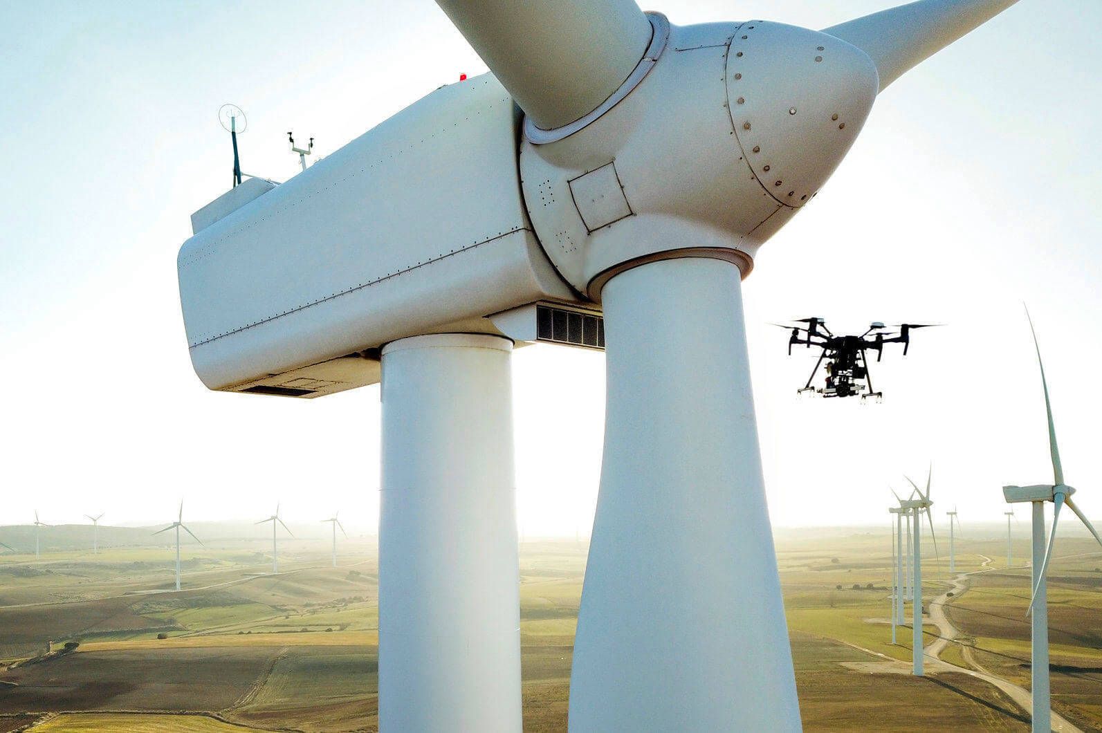
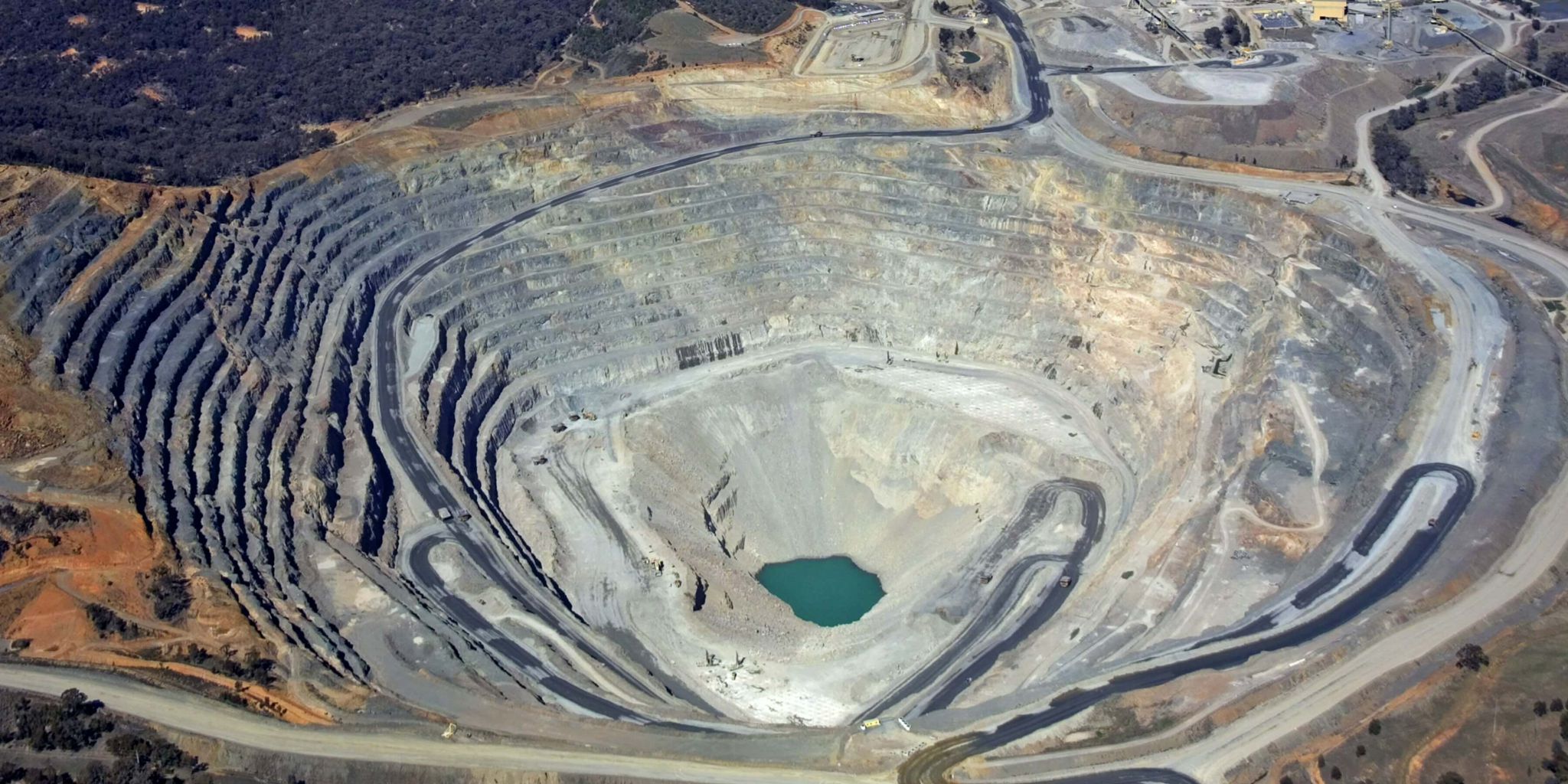
Inspection à distance d'installations industrielles complexes et de toitures sans échafaudage ni risque humain. Ferninspektion komplexer Industrieanlagen und Dächer ohne Gerüste oder menschliches Risiko. Remote inspection of complex industrial facilities and roofs without scaffolding or human risk. Inspectie op afstand van complexe industriële installaties en daken zonder steigers of menselijk risico.
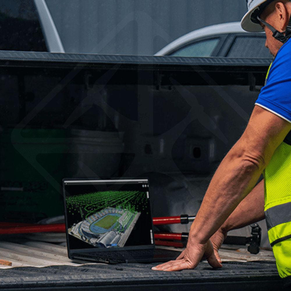
Traitement avancé des images pour générer des orthophotos et modèles 3D exploitables dans vos logiciels métiers. Erweiterte Bildverarbeitung zur Erstellung von Orthofotos und 3D-Modellen, die in Ihrer Software nutzbar sind. Advanced image processing to generate orthophotos and 3D models usable in your business software. Geavanceerde beeldverwerking om orthofoto's en 3D-modellen te genereren die bruikbaar zijn in uw bedrijfssoftware.
Documentation visuelle continue. Prises de vues régulières et rapports d'avancement détaillés des phases de construction. Kontinuierliche visuelle Dokumentation. Regelmäßige Aufnahmen und detaillierte Fortschrittsberichte der Bauphasen. Continuous visual documentation. Regular aerial shots and detailed progress reports of construction phases. Continue visuele documentatie. Regelmatige opnames en gedetailleerde voortgangsrapporten van de bouwfases.